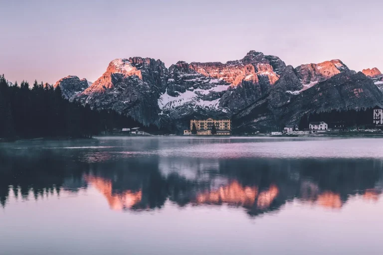
Lake Ingalls , Washington- All need to know
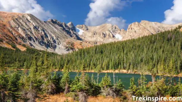
Lake Ingalls is a stunning glacial lake located in the Alpine Lakes Wilderness in Chelan County, Washington. The lake is known for its crystal-clear water, magnificent views of Mount Stuart, and its challenging, yet rewarding, hike.
The hike to Lake Ingalls is approximately 9.5 miles round trip and gains about 3,200 feet in elevation. The trail is considered to be difficult, but it is well-maintained and offers breathtaking views of the surrounding mountains and valleys.
- Location: Chelan County, Washington, USA
- Elevation: 6,467 feet (1,971 meters)
- Type: Glacial lake
- Activities: Hiking, camping, backpacking, photography, fishing
- Difficulty: Moderate to challenging
- Season: July–October
Highlights:
- Magnificent scenery: The lake boasts stunning turquoise waters surrounded by lush meadows, towering peaks, and the iconic Mount Stuart as a majestic backdrop.
- Diverse landscape: The hike to the lake takes you through a variety of landscapes, including forests, meadows, and rocky slopes, offering a captivating journey.
- Abundant wildlife: You might encounter mountain goats, deer, marmots, and various birds during your hike
- Camping and backpacking opportunities: There are designated campsites near the lake, allowing you to extend your adventure and immerse yourself in the wilderness.
- Photography paradise: The lake’s beauty, surrounding mountains, and vibrant wildflowers make it a photographer’s dream.
History of Lake Ingalls, Washington
Lake Ingalls, nestled amidst the stunning peaks of the Alpine Lakes Wilderness, boasts a rich and fascinating history intertwined with exploration, mining, and recreation. Here’s a glimpse into the past of this captivating lake:
Native American Presence:
- While the exact timeline isn’t documented, Native American tribes like the Yakama and Wenatchi likely inhabited the area around Lake Ingalls for generations, utilizing the natural resources and appreciating the beauty of the landscape.
1855: Exploration and Naming:
- Captain Benjamin Ingalls, leading a survey crew for the Pacific Railroad, is credited with discovering the lake in 1855. He named it after himself, marking the beginning of the lake’s recorded history.
1860s-1880s: Mining Boom:
- The discovery of gold in the Teanaway River valley during the 1860s sparked a mining boom. Prospectors flocked to the area, including the shores of Lake Ingalls, searching for their fortune.
- Mining activity left its mark on the landscape, with remnants of old mining roads and cabins still visible today.
1906: Forest Service and Recreation:
- With the establishment of the Forest Service in 1906, the area surrounding Lake Ingalls fell under government protection. The focus shifted from resource extraction to recreation and conservation.
- The construction of trails and campgrounds facilitated access to the lake, allowing visitors to enjoy its pristine beauty.
1960s-Present: Wilderness Designation and Preservation:
- In 1968, large portions of the Alpine Lakes region, including Lake Ingalls, were designated as the Alpine Lakes Wilderness. This designation ensured the long-term protection of the area’s natural resources and ecological integrity.
- Today, Lake Ingalls remains a popular destination for hiking, camping, fishing, and photography. Visitors can explore the lake’s shores, admire the surrounding peaks, and experience the tranquility of the wilderness.
Best Hiking Trails Around Lake Ingalls
Lake Ingalls sits in the heart of the Alpine Lakes Wilderness in Washington, surrounded by stunning mountains and offering a variety of hiking trails to explore. Here are some of the best options for all levels of experience:
1. Lake Ingalls Trail:
This classic 9-mile out-and-back trail is the most popular route to the lake. It offers a moderate to challenging hike with an elevation gain of 3,200 feet. The trail winds through forests, meadows, and rocky slopes, offering stunning views along the way. Read Lake Isabelle Colorado- All about to know
2. Esmeralda Basin Trail:
This 7-mile out-and-back trail takes you to Esmeralda Basin, a stunning alpine meadow with vibrant wildflowers in the summer. The trail is moderately challenging with an elevation gain of 2,600 feet.
3. Bean Creek Trail:
This 5-mile out-and-back trail offers a more moderate hike with an elevation gain of 1,600 feet. The trail follows Bean Creek through a beautiful forest, leading to a scenic viewpoint overlooking the valley below.
4. Longs Pass Trail:
This 13-mile out-and-back trail is a challenging option for experienced hikers. It offers stunning views of the surrounding mountains and passes through a variety of ecosystems.
5. Iron Peak Trail:
This 6-mile out-and-back trail offers a moderate to challenging hike with an elevation gain of 2,400 feet. The trail leads to the summit of Iron Peak, which offers panoramic views of the surrounding wilderness.
Lake Ingalls Weather
The weather at Lake Ingalls can vary depending on the time of year, but it is generally cool and wet. The average temperature in July is 60 degrees Fahrenheit (15 degrees Celsius), and the average temperature in January is 20 degrees Fahrenheit (-7 degrees Celsius).
The lake is located in the Cascade Mountains, which means that it can experience snowfall in the winter. The average snowfall in December is 60 inches (152 centimeters).
Here is a more detailed breakdown of the weather at Lake Ingalls:
Spring (March-May)
- Average temperature: 40-50 degrees Fahrenheit (4-10 degrees Celsius)
- Precipitation: Rain and snow are possible, but the weather is generally pleasant.
- Hiking: The trails are snow-free and the wildflowers are blooming.
Summer (June-August)
- Average temperature: 60-70 degrees Fahrenheit (15-21 degrees Celsius)
- Precipitation: Rain showers are possible, but the weather is generally sunny and warm.
- Hiking: This is the best time of year to hike to Lake Ingalls, as the trails are clear and the views are spectacular.
Fall (September-November)
- Average temperature: 50-60 degrees Fahrenheit (10-15 degrees Celsius)
- Precipitation: Rain and snow are more likely, and the days are shorter.
- Hiking: The trails may be snow-covered at higher elevations, so be prepared for colder temperatures.
Winter (December-February)
- Average temperature: 20-30 degrees Fahrenheit (-7-1 degrees Celsius)
- Precipitation: Snowfall is common, and the lake is often frozen.
- Hiking: The trails are covered in snow, and hiking is not recommended unless you are experienced with winter hiking.
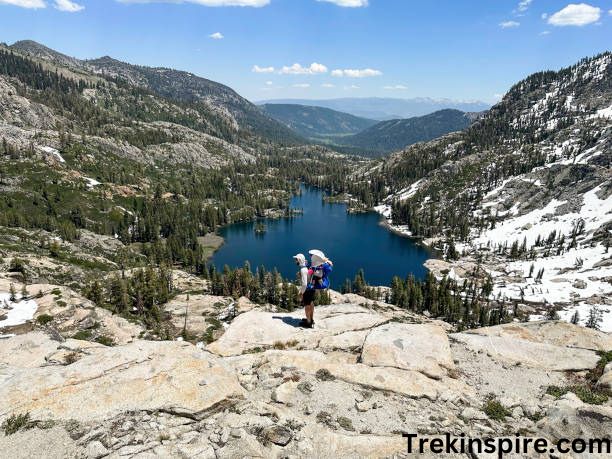
Lake Ingalls Trailhead
The adventure begins on Forest Road 9737, a scenic drive through pristine forests alongside the Teanaway River. Approximately 9.5 miles from the turnoff onto 9737, you’ll reach the Esmeralda Trailhead, where your journey officially begins.
The Trail:
From the Esmeralda Trailhead, the Ingalls Way Trail #1390 leads you through a diverse landscape. The first section winds through a serene forest, gradually gaining elevation as it follows the Ingalls Creek. As you climb, the forest thins, revealing panoramic vistas of the surrounding mountains.
At the 2-mile mark, you’ll reach a junction with the Longs Pass Trail. Keep right to continue towards Lake Ingalls. The trail continues to climb steadily, crossing several small streams and meadows.
The final push to the lake is the most challenging. The trail switchbacks steeply through rocky terrain, requiring good stamina and sure footing. However, the effort is well worth it as the magnificent turquoise waters of Lake Ingalls come into view.
The Destination:
Upon reaching the lake, you’ll be greeted by a breathtaking panorama of snow-capped peaks, lush meadows, and the iconic Mount Stuart dominating the skyline. This pristine alpine setting is perfect for picnicking, soaking in the scenery, or exploring the surrounding area. Read Tunnel Springs Park – North Salt Lake, Utah
Additional Information:
- Trail Length: 9 miles (14.5 km) out-and-back
- Elevation Gain: 3,200 feet (975 meters)
- Difficulty: Moderate to challenging
- Facilities: Limited parking and restrooms are available at the Esmeralda Trailhead.
Restrooms Near Lake Ingalls
There are several restroom options available near Lake Ingalls, depending on your starting point and chosen trail:
1. Ingalls Pass Trailhead:
- A vault toilet is located directly at the Ingalls Pass Trailhead, offering a convenient option before or after your hike.
2. Ingalls Creek Trail:
- Approximately 1.5 miles along the Ingalls Creek Trail, you’ll find another vault toilet located near the Ingalls Creek crossing.
3. Lake Ingalls:
- While there are no restrooms directly at Lake Ingalls, you can find another vault toilet 1.6 miles back down the trail at the junction of the Ingalls Pass and Ingalls Creek Trails.
Camping gear for your Lake Ingalls adventure
Unfortunately, camping is not allowed directly at Lake Ingalls. However, there are numerous designated campsites located in the surrounding area, particularly in Headlight Basin, which is just a short distance from the lake. Here’s a guide to essential camping gear for your Lake Ingalls adventure:
Shelter:
- Tent: A sturdy, lightweight tent suitable for the alpine environment is crucial. Consider factors like weatherproofing, ventilation, and ease of setup.
- Sleeping bag: Choose a sleeping bag with a temperature rating appropriate for the expected conditions. Remember, temperatures can drop significantly at higher elevations.
- Sleeping pad: A comfortable sleeping pad will insulate you from the cold ground and provide better sleep.
Cooking and Food:
- Backpack stove: A reliable backpacking stove will allow you to cook meals and boil water.
- Fuel: Pack enough fuel for your entire trip, keeping in mind the potential for extra nights due to inclement weather.
- Food: Choose lightweight, high-calorie foods that are easy to prepare and transport. Dehydrated meals, granola bars, nuts, and dried fruits are great options.
- Water bottles and filtration system: Bring plenty of water bottles and a water filtration system to ensure you have access to clean drinking water.
- Mess kit: A mess kit with plates, cups, and utensils will make meal preparation and consumption easier.
Clothing and Gear:
- Hiking boots: Sturdy hiking boots with good ankle support are essential for the challenging terrain.
- Backpack: Choose a comfortable and well-fitting backpack with enough capacity for all your gear.
- Rain gear: Pack a waterproof jacket and pants in case of rain or snow.
- Warm layers: Pack warm layers like fleece jackets and hats, as temperatures can drop significantly at night.
- Sun protection: Sunscreen, sunglasses, and a hat are essential for protecting yourself from the sun.
- Headlamp and flashlight: A headlamp will be crucial for setting up camp in the dark and navigating at night.
- First-aid kit: Pack a first-aid kit with essential supplies to deal with minor injuries.
- Map and compass: A map and compass will help you navigate the trails and find your way back to the trailhead.
- Bear spray: Bear spray is important for bear encounters and should be carried in an easily accessible location. Read Kirkmans Cove Lake
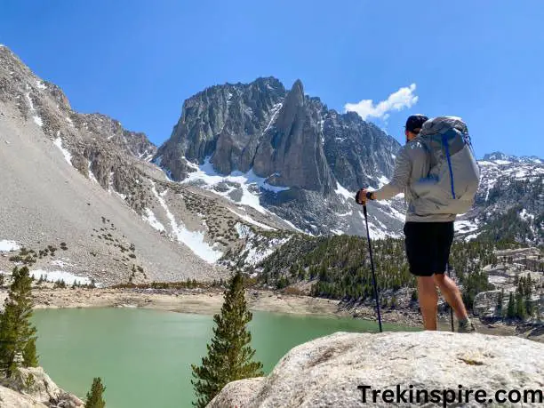
Wildlife Around Lake Ingalls
Lake Ingalls is a haven for a diverse array of wildlife, adding an element of wonder to your outdoor adventure. Here are some of the fascinating creatures you might encounter during your visit:
Mammals:
- Mountain Goats: These majestic animals are a highlight for many visitors. They are often seen grazing on the meadows near the lake and are quite accustomed to human presence. However, remember they are wild animals, so observe from a distance and avoid approaching them.
- Mule Deer: These beautiful deer are frequently spotted in the meadows and forests around the lake. They are larger than white-tailed deer and have distinctive mule-like ears.
- Marmots: These playful rodents live in burrows in the rocks and meadows. You might see them sunning themselves on rocks or hear their distinctive whistle calls.
- Black Bears: While black bear sightings are less frequent than other wildlife, it’s important to be aware of their presence. Store food properly, stay alert on the trails, and carry bear spray as a precaution.
Birds:
- Golden Eagles: These powerful raptors soar high above the mountains, offering a breathtaking sight. Keep an eye out for them circling overhead.
- Clark’s Nutcrackers: These curious birds are often seen flitting around campsites and trails, searching for food. They are known for their loud, chattering calls.
- Mountain Chickadees: These tiny songbirds are common in the forests around the lake. Their cheerful calls can brighten your day on the trail.
- Ptarmigans: These white-plumed birds are well-camouflaged in the snowy winter months. You might see them foraging on the slopes above the lake.
Fish:
- Cutthroat Trout: This native fish species thrives in the cool, clear waters of Lake Ingalls. Fishing is allowed with a valid license, but be sure to follow all regulations.
- Golden Trout: This beautiful fish is a popular catch in Lake Ingalls. They are known for their distinctive golden coloring.
- Rainbow Trout: These colorful fish are also found in Lake Ingalls and are another popular target for anglers.
Reptiles and Amphibians:
- Western Tailed Frog: These small frogs are often found near water sources. Their distinctive croaking calls can be heard at dusk and dawn.
- Long-toed Salamander: This salamander lives in damp areas under rocks and logs. It is often seen after rain showers.
This list is not exhaustive, and you may encounter other wildlife species during your visit. Always remember to observe animals from a safe distance and respect their habitat. Read Bickford Park- All about to know
Activities at Lake Ingalls
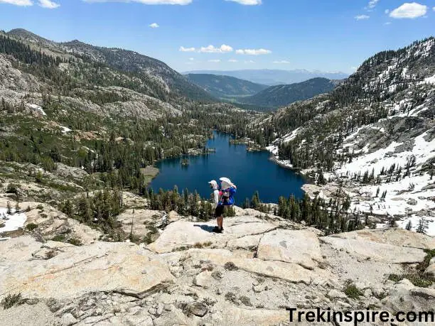
Lake Ingalls, nestled within the Teanaway Arm Recreation Area in Washington state, offers a mesmerizing haven for outdoor enthusiasts. Surrounded by stunning alpine meadows and towering peaks, the lake itself presents a picturesque backdrop for a variety of activities.
Here’s a comprehensive list of things you can do at Lake Ingalls:
Hiking:
- Ingalls Way Trail: This 9-mile roundtrip trail, with an elevation gain of 2,600 feet, leads you directly to the lake, offering panoramic views of the surrounding mountains along the way.
- Esmeralda Basin Loop: Extend your adventure with this challenging 11.5-mile loop trail that incorporates the Ingalls Way Trail and ventures into the breathtaking Esmeralda Basin, featuring vibrant wildflowers and cascading waterfalls.
- Kale Ingalls Trail: For a shorter option, explore the 2-mile roundtrip Kale Ingalls Trail, with minimal elevation gain, leading you to scenic meadows and a serene lake viewpoint.
Camping:
- Lake Ingalls Campground: Immerse yourself in nature at this small, dispersed campground situated directly by the lake. Enjoy the solitude and breathtaking views while camping beneath the stars.
- DeRoux Campground: Located 2 miles away, this larger campground offers designated tent and RV sites, picnic tables, and vault toilets, providing a more comfortable camping experience.
Fishing:
- Cast your line in the crystal-clear waters of Lake Ingalls and try your luck at catching rainbow trout and brook trout. Remember to obtain a Washington State fishing license before you cast your line.
Boating:
- Rent a non-motorized boat (canoe, kayak, or paddleboard) and explore the lake from a different perspective. Enjoy the serenity of the water and soak in the surrounding beauty.
Relaxation:
- Unwind and soak in the tranquility of the wilderness. Enjoy the fresh air, the sound of the water, and the breathtaking views. Read Mahon Park – North Vancouver, British Columbia
Larch Season at Lake Ingalls
Every fall, Lake Ingalls transforms into a golden paradise. Larch trees, shedding their needles for winter, paint the surrounding mountainsides in vibrant yellow. This incredible sight is only visible for a short time, so don’t miss it!
What to expect:
- Hike to a beautiful alpine lake surrounded by golden larches.
- Enjoy stunning panoramic views of the mountains.
- Capture memories of this unique autumn experience.
Planning your trip:
- Hike during late September to early October.
- Allow 6.2 miles and 2,200 feet of elevation gain.
- Difficulty level: challenging.
- Bring hiking boots, water, snacks, lunch and warm layers.
- Check current conditions before heading out.
Ingalls Pass
Ingalls Pass is a beautiful and challenging hike located in the Alpine Lakes Wilderness of Washington State. The hike offers stunning views of Mount Stuart, the Ingalls Peaks, and the surrounding valley. Here’s a summary of what you can expect:
- Location: Alpine Lakes Wilderness, Washington State
- Trailhead: Ingalls Pass Trailhead, 47.436733, -120.937038
- Distance: 6.2 miles to Ingalls Pass, 7.8 miles to Lake Ingalls
- Elevation Gain: 2,200 feet
- Difficulty: Difficult
- Season: Summer and early fall (snow may be present at other times)
Best Features:
- Breathtaking panoramic views of Mount Stuart, Ingalls Peaks, and the valley below
- Crystal-clear Lake Ingalls (optional)
- Diverse alpine flora and fauna
- Peaceful and secluded wilderness setting
Hike Details:
The hike begins at the Ingalls Pass Trailhead and follows a well-maintained trail through a forest of Douglas fir and western red cedar. After about 1.5 miles, the trail reaches a viewpoint with stunning views of the valley below. The trail then continues uphill through a series of switchbacks, offering increasingly breathtaking vistas.
At around 3 miles, the trail reaches Ingalls Pass, which provides 360-degree views of the surrounding mountains and valleys. From here, you can continue another 1.6 miles to Lake Ingalls, a beautiful alpine lake nestled beneath the Ingalls Peaks.
Additional Information:
- Dogs: Allowed on leash
- Water: No water available on the trail, so be sure to bring plenty of your own
- Restrooms: Available at the trailhead
Ingalls Peak South Ridge
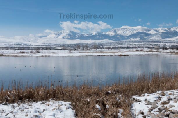
The Ingalls Peak South Ridge is a popular and challenging climb in the Alpine Lakes Wilderness of Washington State. It offers stunning views of Mount Stuart, the Ingalls Peaks, and the surrounding valley. Here’s what you need to know about this classic climb. Read Corman Park Vet
Technical Information:
- Height: 7,640 feet
- Length: 3 pitches
- Difficulty: 5.4 YDS
- Exposure: Moderate
- Season: Summer and early fall
Route Description:
The South Ridge climb begins at the Ingalls Lake trailhead. From there, you’ll hike approximately 6.2 miles to the base of the climb. The route itself consists of three pitches:
- Pitch 1: This pitch begins with a low-angle climb up a large crack in the middle of a slab. It then leads to a ledge, where you’ll anchor yourself for the next pitch.
- Pitch 2: This pitch offers several variations, with the easiest being a crack on the far left. It leads to another ledge, where you’ll anchor yourself for the final pitch.
- Pitch 3: This pitch involves a series of exposed moves on a slab, culminating in a summit ridge that offers incredible views of the surrounding area.
Longs Pass
Longs Pass, located in the Alpine Lakes Wilderness of Washington State, is a scenic mountain pass that offers stunning views and access to a variety of hiking and backpacking opportunities. Here’s a summary of what you can expect:
- Location: Alpine Lakes Wilderness, Washington State
- Coordinates: 47.407778, -120.928333
- Elevation: 6,200 feet
- Activities: Hiking, backpacking, camping, fishing, wildlife viewing
Features:
- Panoramic views of the surrounding mountains, including Mount Stuart and the Ingalls Peaks
- Diverse alpine flora and fauna
- Access to several popular trails, including the Ingalls Lake Trail and the Ingalls Creek Trail
- Peaceful and secluded wilderness setting
Hike Details:
The Longs Pass Trail is a 7-mile out-and-back trail with an elevation gain of 2,200 feet. The trail is considered difficult due to the steep sections and strenuous climb. The trail begins at the Ingalls Creek Trailhead and follows a well-maintained path through a forest of Douglas fir and western red cedar. After about 1.5 miles, the trail reaches a viewpoint with stunning views of the valley below. The trail then continues uphill through a series of switchbacks, offering increasingly breathtaking vistas.
At around 3 miles, the trail reaches Longs Pass, which provides 360-degree views of the surrounding mountains and valleys. From here, you can continue another 1.6 miles to Lake Ingalls, a beautiful alpine lake nestled beneath the Ingalls Peaks.
Esmeralda Basin
Esmeralda Basin, nestled within the majestic Alpine Lakes Wilderness of Washington state, is a haven for outdoor enthusiasts and nature lovers alike. This breathtaking basin offers a variety of experiences, from challenging hikes to serene camping adventures.
Here’s a comprehensive guide to help you plan your own unforgettable trip to Esmeralda Basin:
Location and Access:
Esmeralda Basin is located approximately 25 miles west of Cle Elum, Washington. The main access point is the Esmeralda Trailhead, which can be reached via Forest Service Road 9737.
Hiking:
- Esmeralda Basin Trail: This 7-mile out-and-back trail offers moderate difficulty with an elevation gain of 1,750 feet. The trail winds through a beautiful forest, past a vibrant wildflower meadow, and ascends to Fortune Creek Pass, where stunning panoramic views of the surrounding peaks await.
- Esmeralda Basin Loop Trail: This 11.5-mile loop trail offers a more challenging adventure with an elevation gain of 2,300 feet. The trail incorporates the Esmeralda Basin Trail and continues along the Fortune Creek Jeep Trail, offering diverse landscapes and breathtaking vistas.
Camping:
- Esmeralda Basin Campground: This small, dispersed campground offers a primitive camping experience within the basin itself. Sites are on a first-come, first-served basis and offer limited amenities (fire rings and basic restrooms).
- Fortune Creek Campground: This larger campground provides a more comfortable camping option with designated sites, picnic tables, and vault toilets.
Esmeralda Trailhead
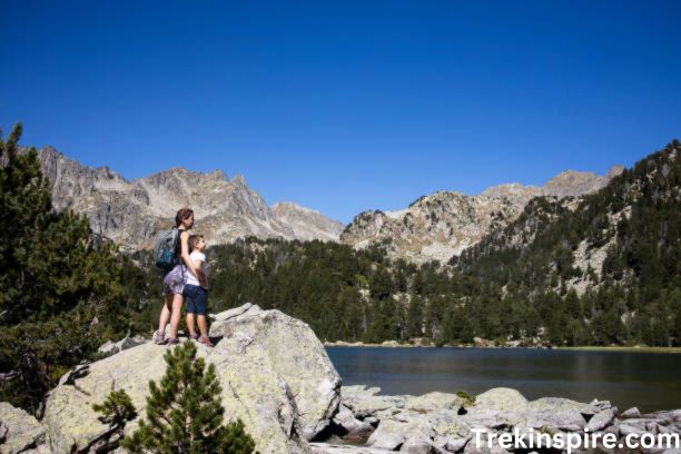
The Esmeralda Trailhead is your gateway to stunning natural beauty and diverse outdoor experiences within the Alpine Lakes Wilderness of Washington. Located approximately 25 miles west of Cle Elum, this trailhead marks the beginning of two popular trails:
1. Esmeralda Basin Trail:
- Distance: 7 miles out-and-back
- Difficulty: Moderate
- Elevation gain: 1,750 feet
- Highlights: Meadows bursting with wildflowers, scenic views of Fortune Creek Pass, pristine lakes, and diverse wildlife.
2. Esmeralda Basin Loop Trail:
- Distance: 11.5 miles loop
- Difficulty: Moderate to challenging
- Elevation gain: 2,300 feet
- Highlights: Combines the Esmeralda Basin Trail with the Fortune Creek Jeep Trail, offering panoramic vistas, cascading waterfalls, and a variety of landscapes.
Crystal Lakes Hike in the Alpine Lakes Wilderness
The Crystal Lakes Hike in the Alpine Lakes Wilderness offers a rewarding adventure for those seeking a moderate challenge and breathtaking scenery. This 6-mile roundtrip trail is perfect for experienced hikers and those seeking a scenic escape in the heart of Washington’s mountains.
Here’s a detailed breakdown of what you can expect on your hike:
- Trailhead: Crystal Lake Trailhead, located approximately 4 miles north of Cayuse Pass on SR 410.
- Difficulty: Moderate
- Distance: 6 miles roundtrip
- Elevation Gain: 2,300 feet
- Season: Late-June to October (weather conditions may vary)
- Permits: Northwest Forest Pass required for parking
The Journey:
- The first half of the trail is a gradual incline through a dense forest, providing cool shade and a peaceful atmosphere.
- As you ascend, the forest gives way to meadows brimming with wildflowers during the summer months, adding bursts of color to the landscape.
- The trail continues to climb, offering occasional glimpses of the surrounding peaks and valleys, building anticipation for the stunning views to come.
The Crystal Jewels:
- Lower Crystal Lake: After approximately 2.5 miles, you’ll reach the first reward – Lower Crystal Lake. This emerald-green lake is nestled amidst towering mountains and provides a perfect spot for a break, a refreshing dip, or a picturesque picnic lunch.
- Upper Crystal Lake: For those seeking an extra challenge, continue hiking for another 0.5 miles to reach the hidden gem, Upper Crystal Lake. This smaller and more secluded lake offers a serene atmosphere perfect for contemplation and soaking in the natural beauty.
Glacier basin WTA
Glacier Basin, nestled within Mount Rainier National Park, offers a diverse and rewarding hiking experience for all levels of adventurers. Here’s a detailed breakdown of what you can expect on this stunning trail:
Location and Trailhead:
- Region: Mount Rainier National Park, Washington
- Trailhead: White River Campground
- Distance: 3.25 miles roundtrip
- Elevation gain: 1,280 feet
- Difficulty: Moderate
Hiking Options:
- Glacier Basin Loop: This is the classic hike, offering breathtaking views of the basin, Inter Fork River, and surrounding peaks.
- Emmons Moraine Side Trip: Add approximately 3 miles to your hike for even more spectacular views and a closer look at the glacier.
- Sunrise Camp and Shadow Lake: Extend your adventure by adding a night at Sunrise Camp and visiting Shadow Lake, known for its vibrant wildflowers during summer months.
Seasonality:
- Summer (late June to early September): Ideal conditions with warm temperatures, clear skies, and wildflowers in bloom.
- Fall (September to October): Cooler temperatures, vibrant fall foliage, and potential for snow at higher elevations.
- Winter (November to May): The trail is snow-covered and requires winter hiking gear and skills.
Highlights:
- Panoramic views: Witness the grandeur of Mount Rainier and the surrounding mountains from various vantage points.
- Inter Fork River: Enjoy the serene beauty of the cascading river alongside the trail.
- Diverse landscapes: Experience meadows, forests, and the unique glacial basin itself.
- Wildlife: Keep your eyes peeled for deer, marmots, pikas, and various bird species.
- Historical significance: Learn about the area’s history and the impact of glaciers.
Lake Stuart WTA
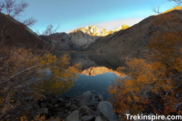
Lake Stuart, nestled within the breathtaking scenery of the Alpine Lakes Wilderness, offers a tranquil escape for hikers of all levels. Here’s a comprehensive guide to help you plan your own adventure:
The Trail:
- Moderate challenge: The trail features an elevation gain of 2,300 feet, but the well-maintained path and gradual incline make it accessible to hikers of moderate fitness levels.
- Diverse terrain: Experience the vibrant beauty of the Pacific Northwest as you traverse through meadows bursting with wildflowers, dense forests, and rocky outcroppings.
- Scenic views: As you ascend, breathtaking vistas of the surrounding mountains unfold, offering unparalleled panoramic views.
The Crystal Jewels:
- Lower Lake Stuart: This emerald-green lake is the first reward for your efforts. Surrounded by towering peaks and vibrant foliage, it’s a perfect spot for a picnic lunch or a refreshing dip.
- Upper Lake Stuart: Continue your journey for a short distance to reach the hidden gem, Upper Lake Stuart. This smaller and more secluded lake offers a serene atmosphere perfect for contemplation and soaking in the natural beauty.
Essential Information:
- Location: Lake Stuart Trailhead, Washington (approximately 4 miles north of Cayuse Pass on SR 410)
- Difficulty: Moderate
- Distance: 6 miles roundtrip
- Elevation gain: 2,300 feet
- Season: Late-June to October (weather conditions may vary)
- Permits: Northwest Forest Pass required for parking
Goat Rocks WTA
The stunning Goat Rocks Wilderness in Washington state offers a haven for hiking enthusiasts of all levels. The Washington Trails Association (WTA) provides valuable resources to guide your exploration of this majestic mountain range.
Diverse Trails:
- Easy Hikes: Explore wildflower meadows and scenic overlooks on trails like Snowgrass Flat and Goat Lake.
- Moderate Hikes: Challenge yourself with moderate climbs to viewpoints like The Citadel and Old Snowy, offering panoramic vistas of the surrounding peaks.
- Strenuous Hikes: Experienced hikers can tackle longer, more challenging routes like the Pacific Crest Trail, offering a true wilderness experience.
WTA Resources:
- Detailed Trail Descriptions and Maps: Find comprehensive information on numerous trails within the Goat Rocks Wilderness, including difficulty ratings, elevation gains, and trip reports from other hikers.
- Current Trail Conditions: Stay informed about snowpack, closures, and any potential hazards on your chosen trail.
- Camping Information: Locate designated campgrounds and dispersed camping areas within the wilderness, along with regulations and permits required.
Goat Rocks Wilderness WTA
The Goat Rocks Wilderness, nestled in the heart of Washington’s Cascade Mountains, is a hiker’s paradise. Towering peaks, vibrant wildflower meadows, and crystal-clear lakes await those who venture into this breathtaking landscape. And with the Washington Trails Association (WTA) as your guide, navigating this wilderness wonderland becomes a breeze.
Trails for Every Adventurer:
- Easy Strolls: Experience the beauty of nature on gentle trails like Snowgrass Flat, where wildflowers paint the meadows in vibrant colors.
- Moderate Challenges: Hike through stunning scenery on trails like Goat Lake, where waterfalls cascade down rugged slopes and the pristine lake awaits your arrival.
- Epic Adventures: Push your limits on trails like The Citadel, where breathtaking panoramic vistas reward your climb, or the Old Snowy Mountain, where the summit offers an unforgettable experience.
- Multi-Day Journeys: Embark on the iconic Pacific Crest Trail, traversing diverse landscapes and challenging your endurance, or explore the Goat Rocks Traverse, a loop that will leave you breathless with its scenic beauty.
Beyond the Trails:
The Goat Rocks Wilderness offers more than just incredible hikes. Discover hidden waterfalls, bask in the glow of wildflowers in bloom, or simply relax under the starry sky. Whether you’re a seasoned hiker or a beginner, the Goat Rocks Wilderness has something for everyone.


